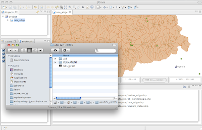
To do it the funky way, just create an empty file named wks.jgrass into the location.

After that, just drag the *.jgrass file into the catalog view of JGrass.
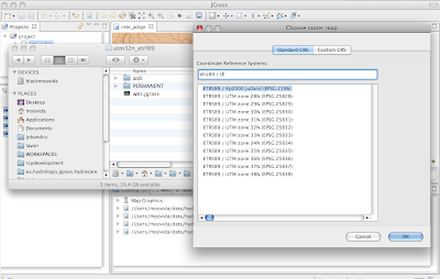
If it is the first time you watch that location in JGrass, then you will be asked to choose the proper projection. This due to an incompatibility of the projection information between JGrass and GRASS.
So you will get a list of projections between which you will have to choose one:

JGrass will create a WKT file with the projection info in it.
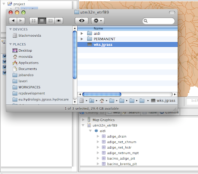
And finally the location appears and you can browse the mapsets and drag the maps into the map window to view them:

There is also an import button on the catalog view that launches a wizard to the import of data.
No comments:
Post a Comment